CANADA'S DRONE INDUSTRY
FAST FACTS
- A drone pilot in Canada earns between $150 to $2,000 per day, depending on the service they are providing and the equipment they are using.
- We refer to a drone as a Remotely Piloted Aircraft System or RPAS. Drone pilots who are providing a service must have an ADVANCED pilot license.
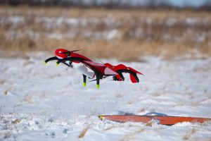
- There are three main categories of drones: fixed-wing, multi-rotor, and hybrid.

We are dedicated to building a robust RPAS industry that is owned by the people it serves. In remote communities that are often isolated when ice roads melt, this is a critical mission. It’s also vital that we engage and develop our youth.
AN OVERVIEW
Remotely Piloted Aircraft Systems (“RPAS”) are commonly known as drones, but you will also see UAV (Unmanned Aerial Vehicle) or UAS (Unmanned Aerial System). They come in three formats:
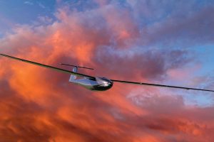
- Fixed-Wing,
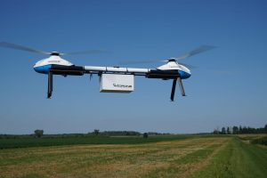
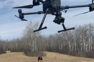
- Rotary-Wing – Quadcopter, Multi-Rotor, etc.
- Hybrid, VTOL (Vertical Take-Off & Landing enabled)
By removing the need for a crew, RPAS can be built lighter and smaller, focused either on cargo (payload) or data collection.
Multi-rotor RPAS can tightly navigate around infrastructure or remain stationary for the purpose of data collection, while fixed-wing RPAS can collect data or transport goods over large distances. In both cases, the typical critical systems for an RPAS include the aircraft, its propulsion system, a flight control unit to automate the control of the aircraft, a suite of flight sensors (GPS, altimeter, Inertial Measurement Unit (IMU) among others), a communications link to transfer data and send command & control (C2) instructions, and a ground control system for the pilot. Together, these systems enable a new class of aircraft able to collect valuable data and operate without any crew on board. (Source: Ontario Society of Professional Engineers)
Every day we are developing new ways to use RPAS. Our ability to automate aerial operations reduces weight, energy use (providing a reduction in greenhouse gas emissions), and cost. Advances in camera sensors, LiDAR, and improvements in data analysis and AI/machine learning provide unique commercial opportunities. In 2016, there were 110,000 drones sold for commercial use, and drones as a service (Drone Service Provider – “DSP”) were valued at US$6.6 billion globally (Source: Goldman Sachs research).
Between now and 2020, we forecast a $100 billion market opportunity for drones—helped by growing demand from the commercial and civil government sectors.
Source: Goldman Sachs Research
While Business Insider says:
There’s no arguing the spike in drone industry growth that has occurred in the last few years – the drone services market size is expected to grow to $63.6 billion by 2025, and Insider Intelligence predicts consumer drone shipments will hit 29 million by 2021.
Sales of US consumer drones to dealers surpassed $1.25 billion in 2020, according to Statista. Goldman Sachs forecasts the total drone market size to be worth $100 billion—supported by this growing demand for drones from the commercial and government sectors.
Which Industries Use RPAS?
- Construction & Heavy Industry – the value of global RPAS Service Market $11 billion. Services include monitoring infrastructure and personnel, volumetric calculations of large deposits of material, and environmental data collection. (For more see 2017 IOP Conference Series)
- Agriculture – the value of global RPAS Service Market $5.9 billion. Services include collection and analysis of hy[erspectral imaging data allowing farmers to measure the health of their crops through key indicators including irrigation, levelling, vegetation index and disease monitoring. We can also tell you when a crop is ready for harvest, we can identify the gender of plants (important for Cannabis farmers), and so much more! RPAS in precision agriculture is a game changer. (For more see Science Direct.)
- Infrastructure – the value of the global RPAS Service Market is $1.3 billion. Services include regular and reliable monitoring of utility infrastructure, oil and gas platforms and pipelines, hydroelectric dams, nuclear power stations, wind farms, telecom infrastructure, energy transmission lines, roads, and bridges. Our RPAS can fly long distances, collecting data that can be analyzed in real-time or uploaded, allowing engineers to accurately pinpoint anomalies or areas of risk. (For more see Springer.)
- Natural Resources – the value of the global RPAS service market is $100 million. Sectors include mining and forestry, where the RPAS delivers surveying and prospecting operations. RPAS collects geographic data over a large area through imaging and LiDAR, we integrate that information with geographical information systems (GIS) or analyze the data for surveying metrics (tree levels, canopy height, and tree counts). We also do environmental protection and wildlife management studies – most recently in Churchill assisting in Beluga Whale management. (For more see here.)
These are just a few of the industries that we work for through Drone Service Provider division. The true benefits of RPAS will not be seen until we have a fully autonomous RPAS operating Beyond-Visual-Line-Of-Sight (“BVLOS”) authorized and integrated in our national airspace. That is why we work hard to promote industry regulatory compliance and support the work of regulators.
Fixed-Wing
Multi-Rotor
Quadcopter
